qgroundcontrol
Cross-platform ground control station for drones (Android, iOS, Mac OS, Linux, Windows)
openMVG
open Multiple View Geometry library. Basis for 3D computer vision and Structure from Motion.
ODM
A command line toolkit to generate maps, point clouds, 3D models and DEMs from drone, balloon or kite images. 📷
paparazzi
Paparazzi is a free and open-source hardware and software project for unmanned (air) vehicles. This is the main software
WebODM
User-friendly, commercial-grade software for processing aerial imagery. ✈️ Download it for free!
rotors_simulator
RotorS is a UAV gazebo simulator
GAAS
GAAS is an open-source program designed for fully autonomous VTOL(a.k.a flying cars) and drones. GAAS stands for General
dRehmFlight
Teensy/Arduino flight controller and stabilization for small-scale VTOL vehicles
dronesploit
Drone pentesting framework console
quadrotor
Quadrotor control, path planning and trajectory optimization
flask-restful-example
flask后端开发接口示例,利用Flask开发后端API接口。包含基本的项目配置、统一响应、MySQL和Redis数据库操作、定时任务、图片生成、项目部署、用户权限认证、报表输出、无限层级生成目录树、阿里云手机验证码验证、微信授权、Cele
arpanghosh8453/open-dronelog
Drone Log analyzer: A high-performance universal dashboard application for organizing and analyzing DJI/Litchi flight lo
JcZou/StarryPilot
A lightweight autopilot software for Pixhawk
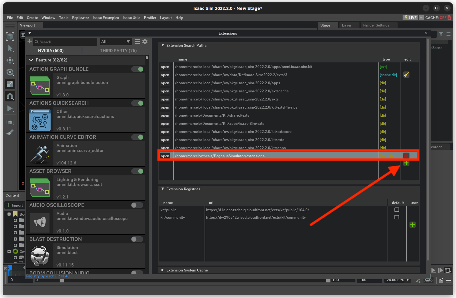
PegasusSimulator/PegasusSimulator
A framework built on top of NVIDIA Isaac Sim for simulating drones with PX4 support and much more
lijx10/uwb-localization
Accurate 3D Localization for MAV Swarms by UWB and IMU Fusion. ICCA 2018
DroneBridge/DroneBridge
DroneBridge is a system based on the WifiBroadcast approach. A bidirectional digital radio link between two endpoints is
webstream-labs/jmuxer
jMuxer - a simple javascript mp4 muxer that works in both browser and node environment.
tbs-trappy/source_one
Open Source FPV Drone Frame
ethz-asl/mav_active_3d_planning
Modular framework for online informative path planning.
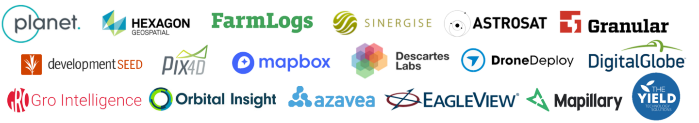
chrieke/awesome-geospatial-companies
:globe_with_meridians: List & Map of 790+ companies for geospatial jobs (GIS, Earth Observation, UAV, Satellite, Digital